


Guide to the FEMA Elevation Certificate V2
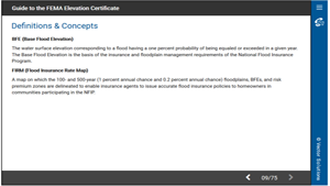
The Elevation Certificate is an important administrative tool of the National Flood Insurance Program (NFIP). It is to be used to provide elevation information necessary to ensure compliance with community floodplain management ordinances, to determine the proper insurance premium rate, and to support a request for a Letter of Map Amendment or Revision (LOMA or LOMR-F). This interactive online course will provide a comprehensive overview of the FEMA elevation certificate and instructions for how to complete one. You will get the information you need and you will have opportunities to practice filling in samples.
Demos + Pricing
Learn more about our courses, get pricing, and see our platform.
Course Details
Learning Objectives
Upon completion of this course, you will be able to:
- Explain where to find information for correct data on the certificate
- Describe the uses of the elevation certificate and its role in LOMA and LOMR-F
- Recognize the building diagrams and examples of each
- Complete an elevation certificate